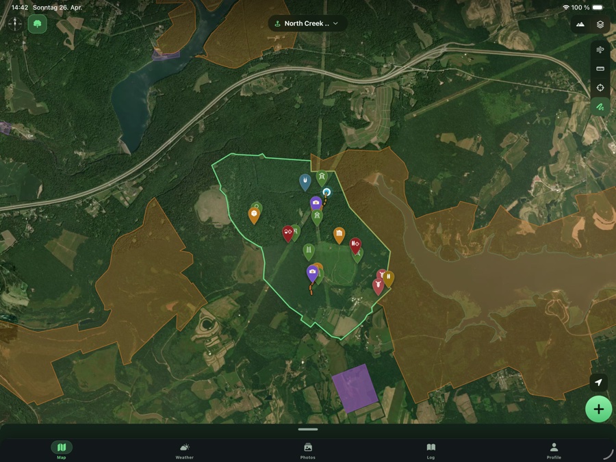
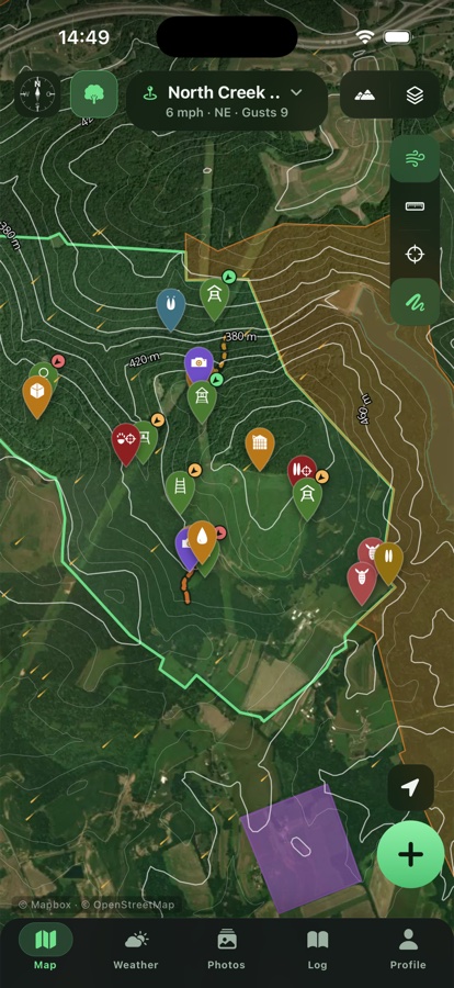
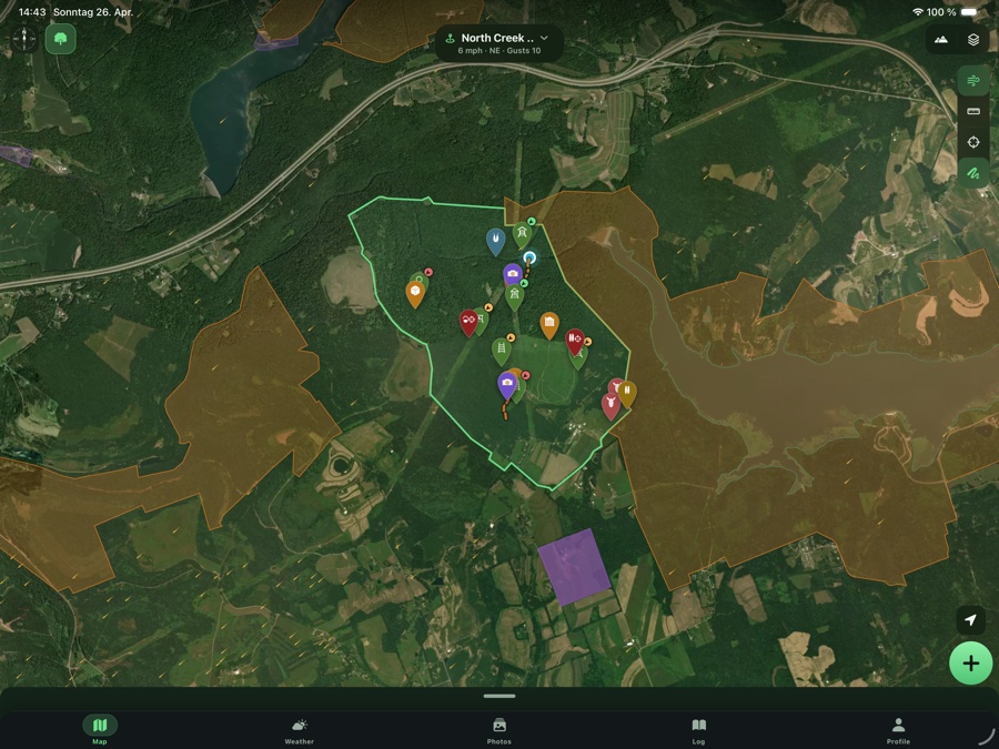
Ground map
Boundaries, trails, stalking paths, access points, hazards — precise in satellite, hybrid with contours, topo or real 3D terrain.
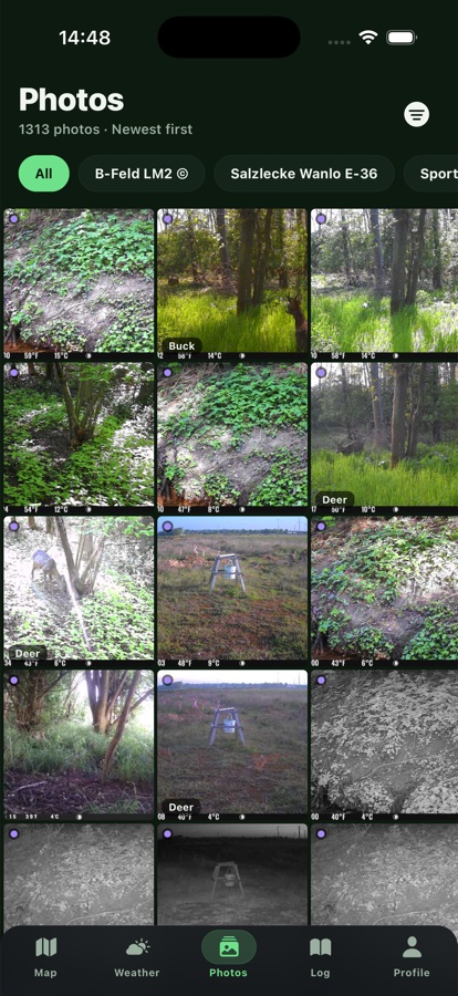
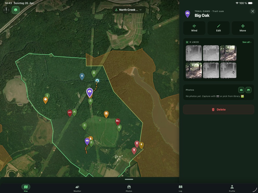
Trail cameras built in
Spypoint and Zeiss SECACAM connect natively. Captures per camera or one central gallery for all cameras — no app switch, no login hassle.
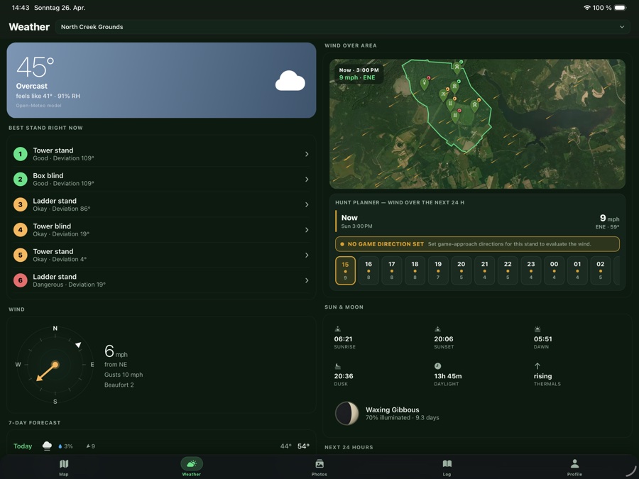
Weather & best stand
Hourly wind, sun, moon phases, shooting light. Plus: HuntrMap calculates which stand fits the wind right now.
Shooting direction editor
Set the hunted sectors per tree stand on a wind rose. In wind mode every stand instantly shows whether your scent blows toward the game trail — color-coded from perfect to dangerous.
Blood-trailing mode
Mark the hit, GPS track records as you go. Drop blood, hair, bone, bed and other signs as points along the way. Fully documented for the trailing crew or your own debrief.
Night mode
Red map tint for the nightly sit. Preserves dark-adapted vision and doesn't spook game. Auto-activates after sunset.
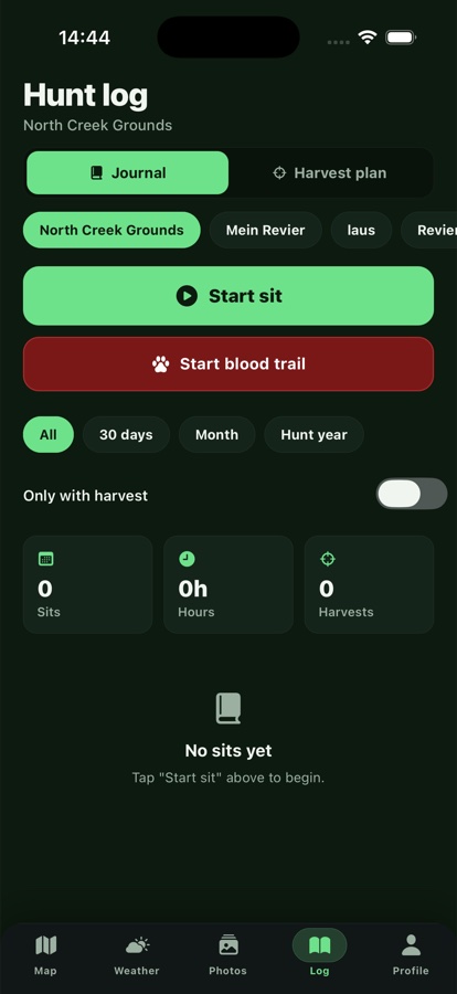
Hunt diary & harvest plan
Log sits with weather snapshot, sightings, harvests. Plus a harvest plan tracker per species and class. Stats, PDF and CSV export.
Markers for everything
Tree stands, box blinds, feeders, bait sites, salt licks, wallows, traps, crop damage, sightings, game trails — over 80 marker types, categorized.
Draw paths and trails
Game trails, stalking paths, access routes, forest roads, hazards. Tap to draw or record live with GPS as you walk.
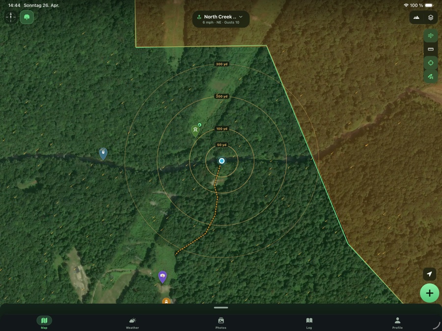
Range finder & range rings
Live measure between two points. Plus overlaid range rings (50/100/150/180 m rifle, bow) around your position.
Offline-capable
Tiles, markers, paths, diary are cached. Even without signal in the woods: location, measuring, marking, notes always work.
Share the ground
Invite guests, lease partners or professional hunters — with read or edit access. Everyone sees the same map in real time.